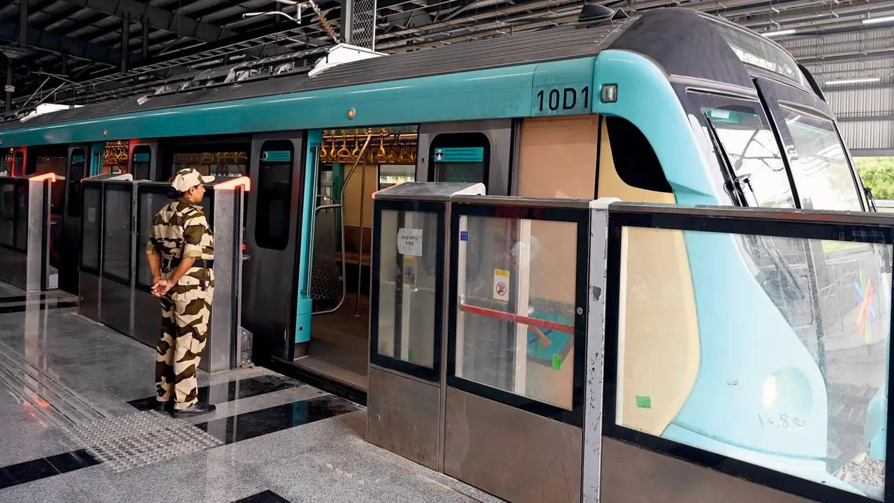
In a major boost to public transit integration, the Brihanmumbai Electricity Supply and Transport (BEST) has announced a comprehensive last-mile connectivity plan for the new phases of Mumbai’s underground Metro Line 3, particularly on the Dharavi to Cuffe Parade corridor. The initiative aims to provide seamless access to 17 metro stations using a fleet of 79 buses across 28 strategically planned routes.

This plan comes as a part of the multi-modal integration strategy to ensure smooth commuter movement and boost metro ridership. BEST presented this plan to Chief Minister Devendra Fadnavis last week, aligning with the larger revival and modernization strategy of Mumbai’s public transport system.
Two-Phase Deployment Strategy
According to BEST officials, the rollout will take place in two phases:
- Phase 1: Focuses on the Dharavi-Acharya Atre Chowk stretch, with 29 buses on 10 ring routes. These services will operate as loop connections around metro stations to ensure commuters can easily transition from train to road transport.
- Phase 2: Covers a broader area in South Mumbai with 50 buses across 18 routes. This includes key destinations such as Colaba, Nariman Point, CSMT, JJ Hospital, Haji Ali, Grant Road, Walkeshwar, Mahalaxmi, and more.
Areas Covered and Ring Routes
The planned bus routes will connect important residential, business, and cultural zones such as Lower Parel, Worli, Dadar, Mahim, Sion, Dharavi, Colaba, Ballard Pier and more. The routes are designed to connect railway stations, business hubs, and metro exits with key neighborhoods, covering distances between 1 km to 4 km from the metro stations.
The buses will run on a ring-route model, similar to existing suburban train and bus networks. This system ensures that passengers have continuous access to frequent buses near every metro station, enhancing efficiency and reducing transit gaps.
Integration with Google Maps for Smart Transit
In a step toward smart mobility, BEST is also partnering with Google Maps. This collaboration will allow real-time integration of:
- Bus route maps
- Fleet data
- Expected time of arrival (ETA)
- Suggested interchanges for metro and bus
Passengers will be able to access real-time updates and directions, improving their overall commuting experience across the city.
Significance for Mumbai Commuters
According to A V Shenoy of the Mumbai Mobility Forum, “Last-mile connectivity is essential, as only then will the metro succeed.” He emphasized the importance of replicating the model used at suburban railway stations where BEST buses are always nearby. This strategy, if executed effectively, could significantly reduce dependency on private vehicles and auto-rickshaws for metro access.
Mumbai’s Metro Line 3 — also known as the Aqua Line — is the city’s first fully underground metro system. With the first phase (BKC to Aarey) already operational since October 7, 2024, the upcoming Dharavi-Acharya Atre Chowk segment is expected to open in the first week of May 2025.
Google Maps Integration for Easy Travel To make the system more user-friendly, BEST is also partnering with Google Maps. This will allow commuters to view bus routes, track bus fleets, and check estimated time of arrival, making daily travel easier and more predictable.
Why Last-Mile Connectivity Matters As per the HT report, transport experts and city planners believe this is a critical step in making the Metro 3 project successful. “Last-mile connectivity is essential. Without it, metro use remains limited,” said A V Shenoy from the Mumbai Mobility Forum. “Just like suburban railway stations have BEST stops nearby, metro stations should have easy bus access too.” With infrastructure being put in place and route planning nearly complete, the initiative aims to offer a comfortable, reliable, and affordable transport option for thousands of daily commuters in Mumbai.
This last-mile connectivity plan is a vital piece of Mumbai’s broader vision for integrated and sustainable urban mobility, addressing the city’s ever-growing traffic and commuting challenges.


